19th Century Maps by Children
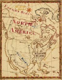
The well known American Cartographer David Rumsey has placed thousands of his own maps online over the past decade. In one of his newer additions he and his colleagues added some two dozen remarkable maps created by children during the 19th century. Many of these old maps were hand drawn and coloured, making them truly one-of-a-kind items. The introduction to this collection notes that "these maps have a special poignancy today in the way that they reflect the optimism of youth from another time". Each map is accompanied by a bit of background information, and visitors are also encouraged to leave their own comments.
Information:
http://www.davidrumsey.com
Redaktion (ph)