Danish history textbook accidentally prints map with relocated iron curtain
While sighting a map of Europe during the cold war in the 60s, an observant reader spotted a few mistakes in a textbook of the Danish publisher Lindhardt & Ringhof. The illustration showed northern Norway and Finland as parts of Soviet Union, the West German state of Schleswig-Holstein as part of East Germany and the countries Turkey, Greece, Albania, Jugoslavia, Bulgaria and large areas of the Middle East as “other communist states”. Confronted with this observation, the publisher admitted that the map would contain the wrong colors and explained the incorrect depiction as a false decision of the editor who was in charge for the map.
The wrong map turned out to be an artistic approach by an Icelander who created an alternate version of the cold war that he published in an online art portal.
Luckily, the affected history textbook hasn’t yet been published due to testings by teachers. Lindhardt & Ringhof assured to release a new version with corrected information.
Editorial staff (sz)
Sources
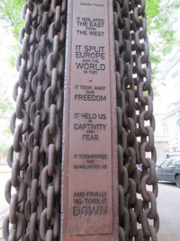
Photo credit: Iron curtain, Budapest by Emily Allen / CC BY 2.0
Information sources: sputniknews.com, deviantart.com